Conceptual Mapping to INSPIRE Data Specifications
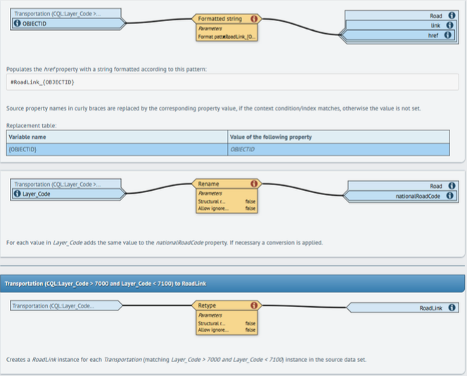
After the initial review and analysis of all data sets, we have picked six source data sets and have created conceptual mapping projects using hale studio 3.0.0 for each of these. The documentation for each one is generated using hale studio’s interactive mapping documentation feature, which results in HTML documents like this one:

No major problems were encountered during conceptual mapping.
Alignment Projects
Use hale studio 3.0.01 to open and view these projects. They define how to transform a data set from a source format, e.g. a shapefile, to INSPIRE GML.
| Project | URL |
|---|---|
| Moldova Administrative Units | Link to Hale Studio File |
| Moldova Hydrography | Link to Hale Studio File |
| Moldova Transport Network - Roads | Link to Hale Studio File |
| Ukraine Administrative Units | Link to Hale Studio File |
| Ukraine Hydrography | Link to Hale Studio File |
| Ukraine Transport Network - Roads | Link to Hale Studio File |
Interactive Documents
Use hale studio 3.0.01 to open and view these projects. They define how to transform a data set from a source format, e.g. a shapefile, to INSPIRE GML.
| Project | URL |
|---|---|
| Moldova Administrative Units | Link to HTML File |
| Moldova Hydrography | Link to HTML File |
| Moldova Transport Network - Roads | Link to HTML File |
| Ukraine Administrative Units | Link to HTML File |
| Ukraine Hydrography | Link to HTML File |
| Ukraine Transport Network - Roads | Link to HTML File |
Excel Mapping Tables
Use hale studio 3.0.01 to open and view these projects. They define how to transform a data set from a source format, e.g. a shapefile, to INSPIRE GML.
| Project | URL |
|---|---|
| Moldova Administrative Units | Link to Excel Mapping Table |
| Moldova Hydrography | Link to Excel Mapping Table |
| Moldova Transport Network - Roads | Link to Excel Mapping Table |
| Ukraine Administrative Units | Link to Excel Mapping Table |
| Ukraine Hydrography | Link to Excel Mapping Table |
| Ukraine Transport Network - Roads | Link to Excel Mapping Table |
